


- Cedar Mountain can be reached along Hwy 14 east from Cedar City
- It is one of the highest points in Dixie National Forest at 9,200 feet
- Many hiking trails around Cedar Mountain start on the canyon floor of Red Canyon
- Red Canyon Campground has 35 sites and is open May to October at $11
Overview
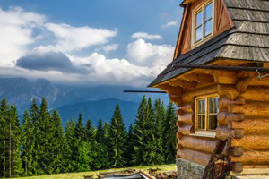
Cedar Mountain UT is one of the most popular areas within Dixie National Forest known for its amazing natural beauty, vibrant foliage and rocky landscape. Bristlecone Pines, one of the oldest living things on earth, flourish on Cedar Mountain and can be up to 4,500 years old.
Location and Information
Cedar Mountain can be reached along Hwy 14 east from Cedar City and along Hwy 89 south of Panguitch. Contact the Red Canyon Visitor Center at 435-676-8815.
Hiking
There are many hiking trails around Cedar Mtn.
- Cascade Falls Trail
Easy family hike
Trailhead at Navajo Lake
Small elevation change
Leads to Cascade Falls - Birds Eye Trail
0.8 mile
Moderate
Starts at the Red Canyon Visitor Center
Close up views of red rock formations - Losee Canyon trail (Hiking, biking and horses)
3 mile
Moderate
Trailhead at the bottom of Losee Canyon
Connects with Cassidy Trail - Arches Trail
0.7 mile
Moderate
Family hike
See 15 natural arches - Pink Ledges Trail
1 mile
Moderate
Starts at Visitor Center
At the junction one path returns to the parking lot; the other goes to Ambush Rock
Mountain Bike Trails
- Red Canyon Bicycle Trail
5 miles
From Thunder Mountain Trailhead to Coyote Hollow Road
No charge
Elevation 7,200 to 8,000 feet - Losee Canyon Trail (Hiking and horses)
2.9 miles
Moderate
Starts at bottom of Losee Canyon
Connects with Cassidy Trail - Cassidy Trail (Hiking and horses)
8.9 miles
Strenuous
Once used by Butch Cassidy to evade the law - Thunder Mountain Trail (Hiking and horses)
7.8 miles
Moderate-strenuous
Outstanding red rock views - Casto Canyon Trail (Hiking and horses)
5.5 miles
Moderate-strenuous
Spectacular scenery
ATV Trails
- Casto Canyon Trail
Loop
Elevation gain 950 feet
Starts at Red Canyon on Forest Service Road 118
Cross Sevier River by bridge and go 4 miles to trail
After a further 4 miles at a junction take the south path to Losee Canyon
See 15 natural arches - Barney Cove Trail
Open to ATVs, this 1.9 mile moderate trail is used primarily to connect Casto Canyon Trail and the Fremont ATV trails.
Campgrounds
- Red Canyon Campground
35 sites with some RV pull throughs
Open May 1 to October 1
$11 per night
Flush toilets
Tables, grills, showers
Fishing
Duck Creek and Duck Creek Pond are well stocked and provide good trout fishing.
Scenic Drive
Drive along Hwy 14 in the fall and see the spectacular color of the aspens in bright reds and golds.