

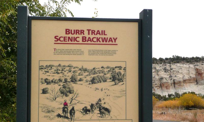
- Burr Trail Road runs for 67 miles between Boulder and Bullfrog
- Allow 2-3 hours minimum one way
- Road is impassable in wet weather
- Unsuitable for trailers due to narrow steep switchbacks
Overview
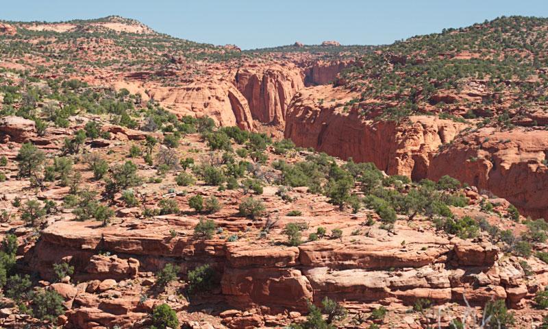
The spectacular Burr Trail Road Utah has steep switchbacks as it descends to Waterpocket Fold. There are many turnoffs to side canyons, arches and the petrified wood at Wolverine Loop Road and incredible scenery throughout the 67-mile journey.
Driving Directions
Leave Boulder and head east along Burr Trail to Bullfrog at Lake Powell. The trail ends at the junction with Hwy 276.
This old cattle trail is paved except for the section through Capitol Reef National Park. High clearance vehicles and 4x4 are recommended, particularly if you plan to explore the side roads. The dirt road may be impassable during wet weather and has steep narrow switchbacks unsuitable for any type of trailer.
Time/Distance
The 67-mile drive runs from Hwy 12 just south of Boulder to Hwy 276 just north of the Bullfrog Marina at Lake Powell.
It takes 2-3 hours one way, but visitors should consider allocating a full day for this trip to allow for side trips and stops at scenic viewpoints.
Highlights
- Drive through scenic Glen Canyon National Recreation Area with its red mesas
- Enjoy the sights at the steep walled Long Canyon, a colorful gorge similar to Zion Canyon
- See breathtaking scenery at Waterpocket Fold in Capitol Reef National Park
- Take in views of the Henry Mountains at over 11,000 feet elevation, the home of the only free roaming herd of buffalo in the US
- Lake Powell