


- Calf Creek Falls is a 5.5 mile roundtrip to a 126-foot high waterfall
- Spooky Gulch involves a 3-mile roundtrip passing along a narrow slot canyon
- Coyote Gulch hike passes Stevens Arch and a natural bridge along its 11.5 mile roundtrip
- Devils Garden hike offers several criss-crossing trails passing amazing hoodoos
Overview
The Navajo Gorges offer family hikes to swimming holes fed by waterfalls while Coyote Gulch near Escalante has unique challenges and slickrock terrain. Native Indian relics and even dinosaur tracks at the stream near Cottonwood Canyon road make Escalante hiking unique. The Visitor Center is the best place to find suggested routes and information.
Backpackers will need a free backcountry permit from the Visitor Center of self-register at the trailhead registration boxes.
Calf Creek Falls
- Description: Pass ponds and rock art to multicolored cliffs and 126 foot-high waterfall.
- Distance: 5.5 miles Roundtrip
- Trailhead: Callf Creek Recreation Area
- Difficulty: Moderate
Little Death Hollow
- Description: Awesome slot canyon
- Distance: 16 miles Roundtrip
- Trailhead: in Little Death Hollow south of Wolverine Petrified Wood Natural Area
- Difficulty: Moderate
Forty Mile Gulch
- Distance: 11 miles Roundtrip
- Trailhead: 45 miles south of Escalante at Hole-in-the-Rock Road, trailhead beside Sooner Rocks formation
- Difficulty: Moderate but wet
Spooky Gulch
- Description: Narrow slot – not suitable for those suffering from claustrophobia
- Distance: 3.2 miles Roundtrip
- Trailhead: signposted on Hole-in-the-Rock Road, 26 miles south of Escalante
- Difficulty: Moderate
Peek-a-Boo Gulch
- Description: Short slot canyon needing rock-scrambling skills
- Distance: 2 miles Roundtrip
- Trailhead: signposted on Hole-in-the-Rock Road, 26 miles south of Escalante
- Difficulty: Moderate
Devil’s Garden
- Description: Criss-crossing trails of various lengths. Discover numerous hoodoos and the Metate Arch formation.
- Trailhead: signposted on Hole-in-the-Rock Road, 26 miles south of Escalante
- Difficulty: Easy
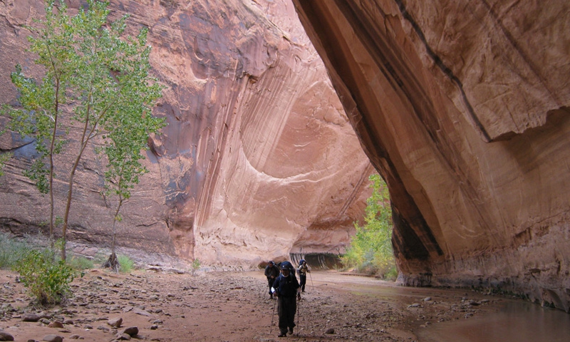
Coyote Gulch
- Description: Pass Stevens Arch and Coyote Natural Bridge
- Distance: 11.5 miles Roundtrip
- Trailhead: at the water tanks, 4.4 miles up Fortymile Ridge Road, Escalante
- Difficulty: Strenuous


